Ooty Facts: Altitude, District, Old Name and What It's Famous For
How high Ooty is, which district it's in, where the name Ootacamund came from and why it's the Queen of Hill Stations, in one quick reference with official sources.
Karpagam Residency, Ooty
Published on 10/18/2026
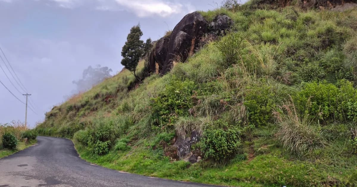
Ooty, officially Udhagamandalam, sits about 2,240 m (7,350 ft) above sea level, according to the town's municipality. It is the headquarters of the Nilgiris district in Tamil Nadu. Under British rule the town was called Ootacamund, and the British shortened that to "Ooty".
We're the team at Karpagam Residency on HMT Road, Ooty. These Ooty facts were checked on 18 October 2026 against official sources: the district administration, the Udhagamandalam municipality, Tamil Nadu Tourism, the India Meteorological Department (IMD), Southern Railway and UNESCO. Where official sources give different figures, we show each one instead of quietly picking one.
Ooty Facts at a Glance
Every figure below was checked on 18 October 2026. The sections after the table link the official source for each one.
| Fact | Ooty |
|---|---|
| Height above sea level | About 2,240 m (7,350 ft). Other official figures run from about 2,200 m to 2,249 m. |
| District | The Nilgiris. Ooty is the district headquarters. |
| State | Tamil Nadu |
| Official name | Udhagamandalam (also spelt Udagamandalam) |
| British-era name | Ootacamund |
| Name in Tamil | உதகமண்டலம் (Udhagamandalam); short form உதகை (Udhagai) |
| Nickname | Queen of Hill Stations |
| Developed by | John Sullivan, Collector of Coimbatore, who began the town's first house in 1822 |
| Population | 88,430 (2011 Census) |
| PIN code | 643001 (head post office) |
| STD code | 0423 |
| Railway | Ooty station is the top of the Nilgiri Mountain Railway from Mettupalayam, the nearest broad-gauge station. The main junction is Coimbatore, about 87 km away. |
| Nearest airport | Coimbatore International Airport, about 88 km |
| Highest peak nearby | Doddabetta, Tamil Nadu's highest peak, about 10 km from Ooty bus stand |
| Average temperatures | Daily highs of 17–23°C and nightly lows of 6.5–12°C (IMD, 1991–2020) |
| Average rainfall | 1,157 mm a year (IMD, 1991–2020) |
How High Is Ooty Above Sea Level?
Ooty is about 2,240 m (7,350 ft) above sea level. That is the figure the Udhagamandalam municipality gives for the town. Other official sources give slightly different numbers, because each one measures a different spot.
The town spreads across a valley, so the height depends on where you stand. The 1908 district gazetteer put Ooty Lake at 7,228 ft and St Stephen's Church at 7,429 ft, about 60 m higher.
| Source | Height | Measured at |
|---|---|---|
| Municipality | 2,240 m | The town |
| IMD | 2,249 m | Its weather station |
| Southern Railway | About 2,200 m | Ooty, on the railway |
| UNESCO | 2,203 m | Top of the toy train line |
For one number, use about 2,240 m, the municipality's figure for the town as a whole. The others come from the IMD climatological tables for 1991–2020 (station height 2,248.8 m), Southern Railway's page on the Nilgiri Mountain Railway and UNESCO's listing of the Mountain Railways of India.
How does Ooty compare with the rest of the Nilgiris?
The Nilgiris district runs from 900 m to 2,636 m above sea level, according to the district administration. Ooty sits in the upper part of that range, below the summit of Doddabetta.
What the height means for the weather
At this height, Ooty stays cool all year. IMD's 1991–2020 averages for its Ooty station show:
- Warmest days: March, with an average high of 23.3°C.
- Coolest days: July, with an average high of 17.2°C.
- Coldest nights: January, with an average low of 6.5°C.
- Records: the lowest reading on the station's record is -2.1°C (January 1976), and the highest is 28.5°C (April 1986).
For month-by-month detail, see our guide to the best time to visit Ooty.
Which District Is Ooty In?
Ooty is in the Nilgiris district of Tamil Nadu, and it is the district headquarters. The District Collector's office, the Collectorate, is in Udhagamandalam, according to the Nilgiris district website. Ooty is not itself a district: it is a town, and Udhagamandalam is also one of the district's taluks.
- Neighbours: the district borders Karnataka to the north, Kerala to the west, and Coimbatore and Erode districts to the east.
- Taluks: Udhagamandalam, Kundah, Coonoor, Kotagiri, Gudalur and Pandalur. A taluk is a sub-district.
- Hill stations: the district counts three: Ooty, Coonoor (19 km from Ooty) and Kotagiri (31 km).
- History: the Nilgiris was separated from Coimbatore district in August 1868. It became a full district, with its own Collector, in February 1882.
- The name: "Nilgiris" means "blue hills", from neelam (blue) and giri (hill or mountain).
What Was Ooty's Old Name, and Where Does It Come From?
Ooty's old name is Ootacamund, the name the British used. The official name today is Udhagamandalam, and "Ooty" is the everyday short form. Tamil Nadu Tourism describes the town as "Udhagamandalam, popularly known as Ooty".
The names you'll see
- Udhagamandalam: the spelling used by the district administration, the municipality and Tamil Nadu Tourism.
- Udagamandalam: the spelling Southern Railway uses for the station, and the one used for the head post office and IMD's weather station.
- Udhagai (உதகை): the short Tamil name, used on the district's Tamil website.
- Ootacamund: the British-era name. The two 1908 government histories of the town and the district both use it.
- Ooty: a British short form. Richard Burton's 1851 book on his 1847 visit already calls the town "Ooty".
Where does the name Ootacamund come from?
Nobody knows for certain. In 1908, Sir Frederick Price wrote a history of the town for the Government of Madras. He said no convincing explanation of the name had been offered, "and I fear that none ever will be".
Most theories agree on the ending: "mund" is the word for a Toda village. The Todas are one of the ancient hill communities of the Nilgiris. The first part of the name is disputed. Price weighed several theories, and these are the main ones:
- A Toda place name (Price's own view): the Toda name for the spot where the first house was built was "Patkh-mud". Price believed Badaga speakers said it as "Whottagemund", which became Ootacamund.
- "Single-stone village": a missionary passed on a Toda story linking the name to the Tamil "ottakal" (single stone), giving "Ootakal-mand". Price dismissed it as "ingenious, but devoid of any foundation".
- A Badaga word: an 1856 book traced the name to a Badaga word, "Hottaga-mund". Price found no such word in Badaga.
The earliest written form is "Wotokymund", in a letter to the Madras Gazette in March 1821, according to the 1908 district gazetteer. You'll find other spellings of the "original" name online, so treat any single answer with caution.
Why Is Ooty Called the Queen of Hill Stations?
"Queen of Hill Stations" is a nickname, not an official title. The Nilgiris district website and Tamil Nadu Tourism both use it, and the district's Tamil site says "Queen of the Hills" (மலைகளின் அரசி). Neither explains where it came from, and we found no official account of who first used it.
What the records do show is how important Ooty became under British rule:
- Summer seat of government: the 1908 gazetteer says Ooty grew into "the capital of a district and the summer head-quarters of the Government" of Madras. The district website calls it the state's "virtual summer capital".
- Raj Bhavan: the Governor of Madras's summer residence, Government House, was built in 1877. Today it is Raj Bhavan, used during the Governor of Tamil Nadu's visits to Ooty.
- A railway of its own: the Nilgiri Mountain Railway reached Ooty from Coonoor on 15 October 1908.
What Is Ooty Famous For?
Ooty is famous for its UNESCO-listed toy train, Nilgiri tea, its gardens and May flower show, Ooty Lake and Doddabetta peak. Two edible souvenirs are famous too: varkey and homemade chocolate. Here is what each one is, with its source.
The Nilgiri Mountain Railway (toy train)
- World Heritage: UNESCO lists it as part of the Mountain Railways of India World Heritage Site. It was added in 2005, according to Southern Railway.
- The line: 46 km of metre-gauge track from Mettupalayam, built between 1891 and 1908, climbing from 326 m to 2,203 m.
- Rack railway: Tamil Nadu Tourism calls it the only operational rack railway in India. Between Kallar and Coonoor, a toothed rail between the running rails grips the train on the steep climb.
Planning a ride? See our Ooty toy train booking guide.
Nilgiri tea
Tea is grown on the district's higher slopes, according to the district horticulture department. "Nilgiri (Orthodox)" tea is a registered Geographical Indication (GI) held by the Tea Board, with its certificate dated 8 December 2008. Tamil Nadu Tourism lists a tea museum and tea factory near Ooty for visitors.
Gardens, Ooty Lake and the flower show
- Government Botanical Garden: 55 acres, run by the Tamil Nadu Horticulture Department. Tamil Nadu Tourism highlights its 20-million-year-old fossil tree trunk.
- Flower show: held every May at the Botanical Garden. The 128th show ran from 18 to 28 May 2026, according to a district press release and news reports.
- Government Rose Garden: on the slopes of Elk Hill, set up to mark the centenary flower show in 1995. Tamil Nadu Tourism says it holds about 20,000 plants from 2,241 varieties.
- Ooty Lake: an artificial lake built by John Sullivan in 1824. It covers 65 acres, and the Tamil Nadu Tourism Development Corporation took it over for boating in 1973, according to the district website.
Doddabetta, Tamil Nadu's highest peak
Doddabetta is the highest peak in Tamil Nadu, about 10 km from Ooty bus stand. Its name means "big mountain" in the Badaga language. Its exact height depends on the source:
- Tamil Nadu Tourism gives 2,637 m.
- The district's Doddabetta page gives 2,623 m.
- The district profile gives the top of the Nilgiris as 2,636 m.
Varkey and homemade chocolate
- Ooty varkey: a crisp, flaky baked snack made with flour, butter and sugar. "Ooty Varkey" is a registered GI, with its certificate dated 31 March 2023.
- Homemade chocolate: Outlook Traveller and Deccan Herald both describe Ooty as known for its homemade chocolates, sold in shops across town. Deccan Herald says it is widely called India's "Chocolate Town".
Forests and hill communities
Ooty sits on the Nilgiri plateau, which the Nilgiri Biosphere Reserve almost completely rings. The Tamil Nadu Forest Department says it was India's first biosphere reserve, set up in 1986. It covers 5,520 km² across Tamil Nadu, Karnataka and Kerala, including Mudumalai and Mukurthi in the Nilgiris. Our Mudumalai safari guide covers a day trip to one part of it.
The municipality describes the district as home mostly to the Badagas, along with ancient tribes such as the Todas, Kotas, Kurumbas, Panias and Irulas.
Where to Stay in Ooty
Our hotel, Karpagam Residency, is on HMT Road in Southwick, 850 m from the Government Rose Garden and 1.9 km from the Government Botanical Garden, the home of the May flower show. Ooty Lake is 3.5 km away.
- Families: the Family Double Room sleeps up to 4 guests.
- Couples: the Deluxe Room has a private balcony and sleeps up to 3.
- Arriving by car: parking and Wi-Fi are free.
- Timing: check-in is from 12:00 PM and check-out by 11:00 AM.
Read more about staying in Ooty.
Frequently Asked Questions
What is the full name of Ooty?
Ooty's full, official name is Udhagamandalam, written உதகமண்டலம் in Tamil and sometimes spelt Udagamandalam. Under British rule it was Ootacamund. In Tamil it is often shortened to Udhagai.
Is Ooty in Tamil Nadu or Kerala?
Ooty is in Tamil Nadu, in the Nilgiris district. The district borders Kerala to the west and Karnataka to the north.
Who founded Ooty?
John Sullivan, then Collector of Coimbatore, is credited with developing Ooty. He began its first house, Stonehouse, in 1822 and built Ooty Lake in 1824. He wasn't the first European to see the valley: the 1908 gazetteer says an unknown party got there in February 1820, but Sullivan was the first European to live there.
What is the PIN code of Ooty?
643001 is the PIN (postal) code of the Udagamandalam head post office, which covers central Ooty, including Charing Cross and the market. Some outlying areas have their own, such as Stone House Hill (643002), Lovedale (643003) and Fernhill (643004).
What is the STD code for Ooty?
The STD code, the area code for landlines, is 0423 for Ooty. The district and municipal offices list their landlines with this code.
How do you get to Ooty?
The nearest airport is Coimbatore International Airport, about 88 km away. The nearest broad-gauge railway station is Mettupalayam, where the toy train starts. If you drive in, apply for an ePass for the Nilgiris on the official TN ePass portal before your date of entry (as of October 2026). Our how to reach Ooty guide and Ooty ePass guide cover the details.
Ooty Facts in Short
Ooty, officially Udhagamandalam, is the headquarters of the Nilgiris district and sits about 2,240 m above sea level. The British called it Ootacamund. Where official figures differ, as they do for the town's height and for Doddabetta, we've shown each source so you can see the range.
To plan a trip, start with our Ooty travel guide and browse places to visit in Ooty. Questions about staying in Ooty? Contact the Karpagam Residency team.
Karpagam Residency, Ooty
★★★★½ 4.6/5 (110+ Google reviews)
HMT Road, Southwick · Mountain views · Free parking & Wi-Fi
Hotels in Ooty →Book Your Ooty Stay
Direct bookings get the best rates - no OTA commissions.